
Client: Singletrack Advocates (STA)
Project: Create a map to connect STA's expanded Hillside trail system with surrounding state park trails.
Industry: Outdoor Recreation
Services: Map design, donor panels, print coordination
Project: Create a map to connect STA's expanded Hillside trail system with surrounding state park trails.
Industry: Outdoor Recreation
Services: Map design, donor panels, print coordination
Highlights:
• Dual coding system for color vision deficiencies
• Map oriented for mountain slope alignment
• Key includes ratings, seasonal notes, and directions
• Collaborated with printer for quality production
• Map oriented for mountain slope alignment
• Key includes ratings, seasonal notes, and directions
• Collaborated with printer for quality production
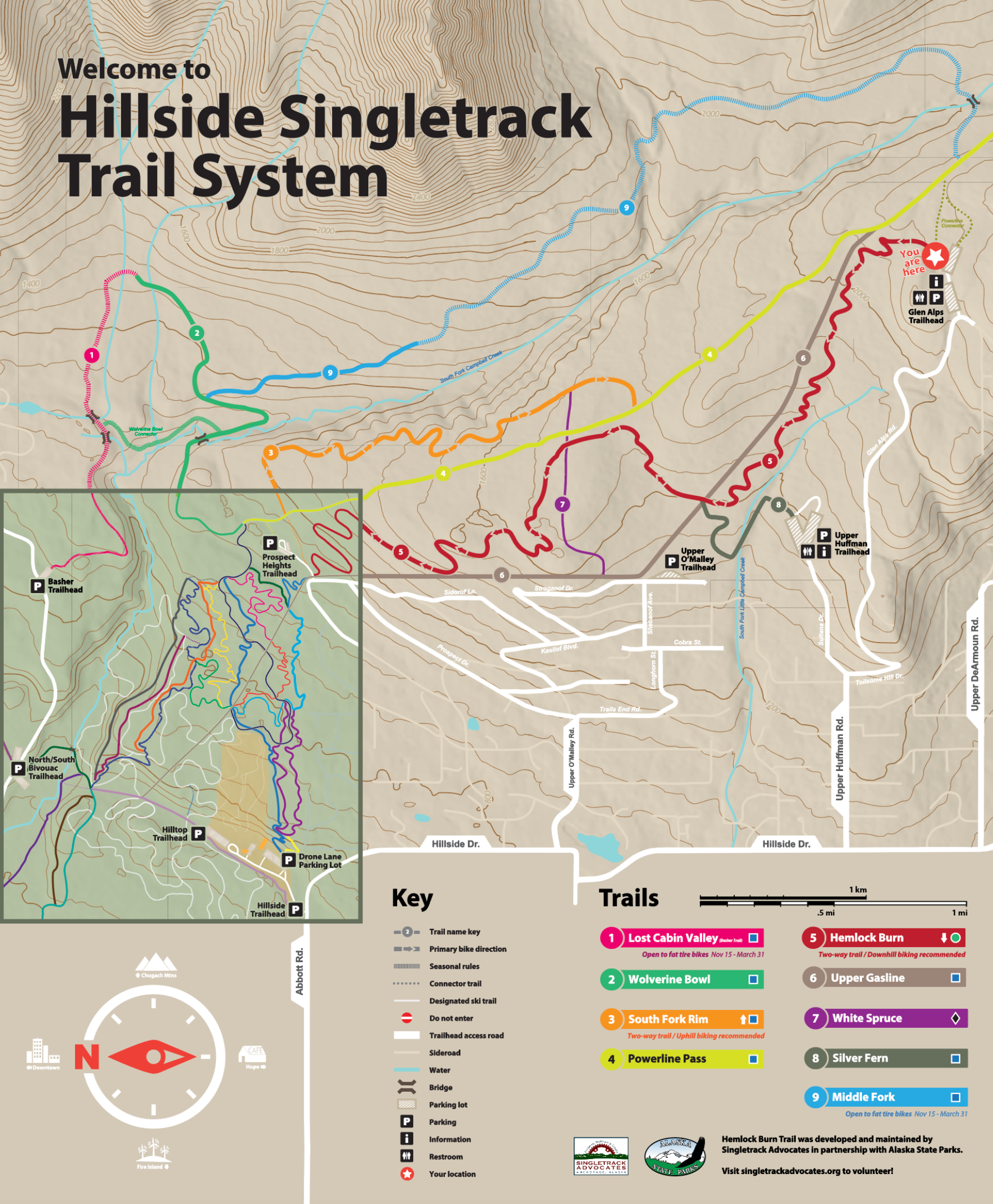
Full map of the Hillside Singletrack Trail System, designed for Singletrack Advocates, showing the extensive STA trail network and connections to surrounding state park trails.
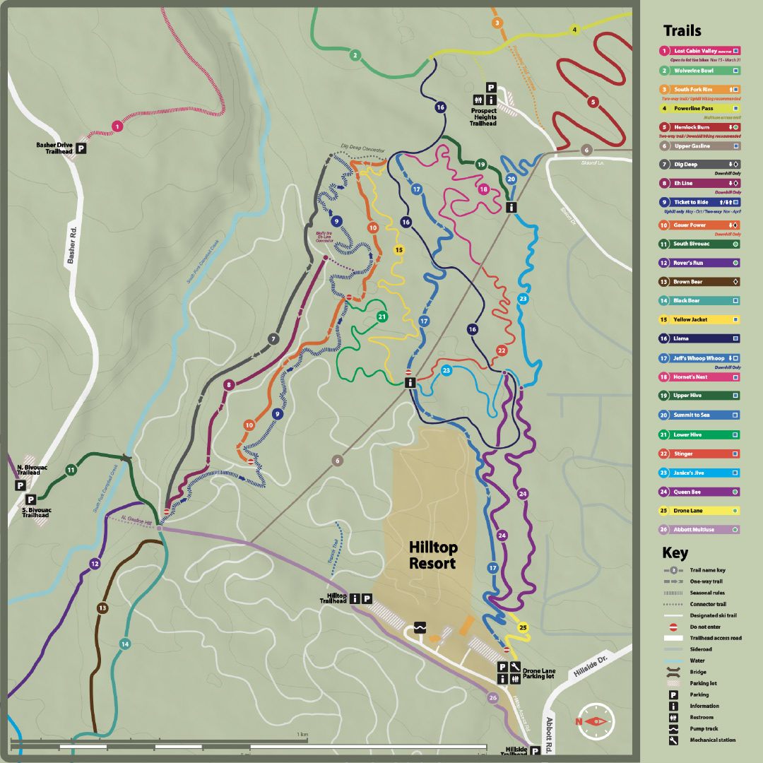
Close-up of map inset, highlighting the STA Hillside network and connection points to nearby trails. The map is oriented with east at the top to align with the mountain slope, allowing users to navigate using gravitational direction, similar to a ski map.
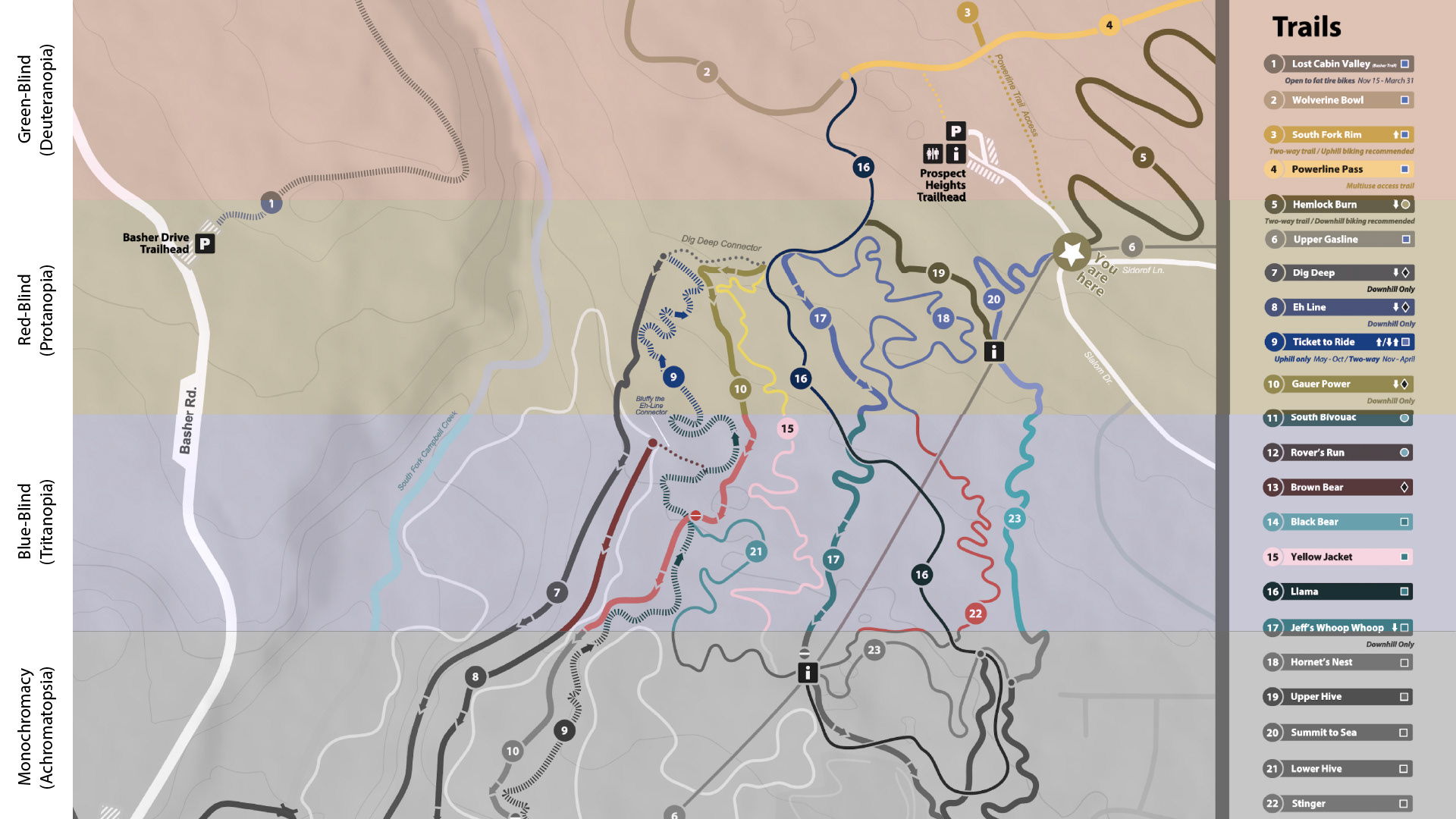
Map tested for four types of color vision deficiency, featuring a dual coding system by color and number to enhance accessibility.
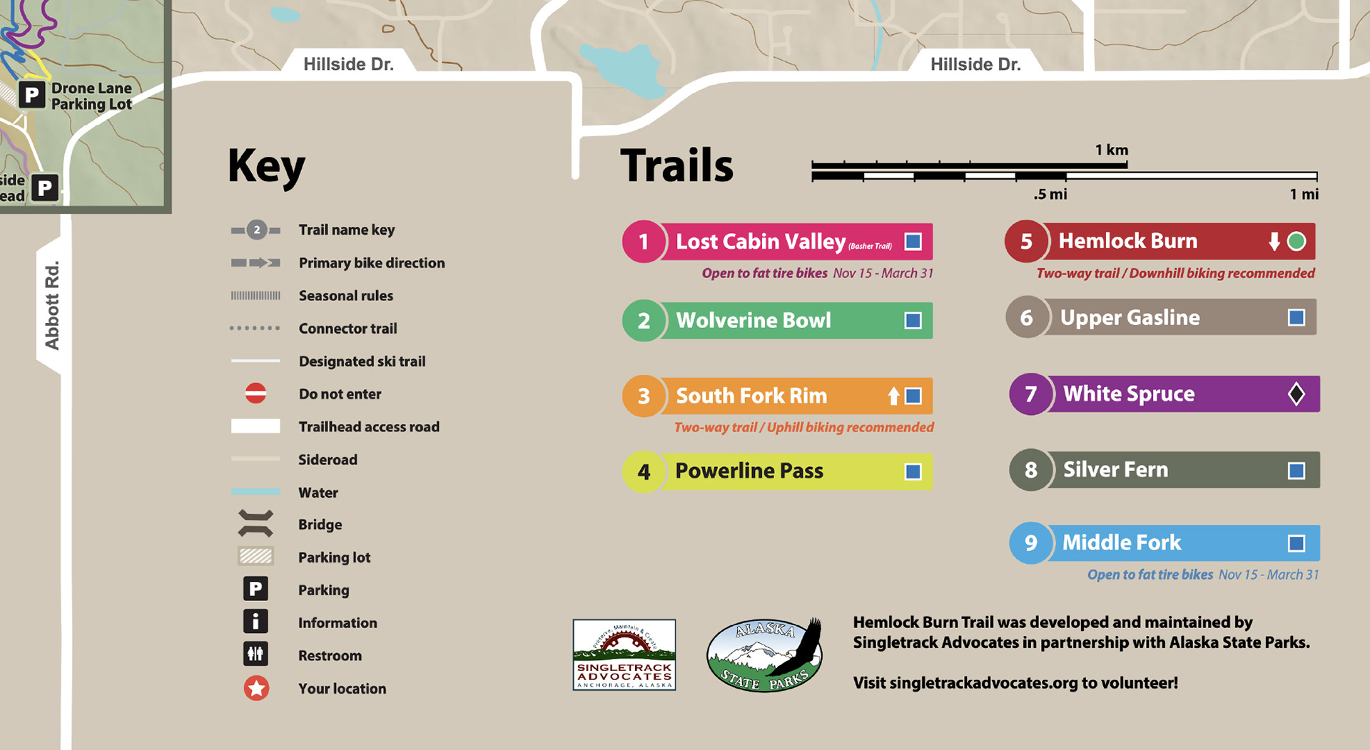
Close-up of the map key, showcasing trail names, logos, website for volunteer contact, along with seasonal and directional notes, and trail ratings.

A. Compass icons, based on popular directional reference points B. Images for icon inspiration C. Widths to reflect trail usage during summer, based on user heatmap data.